 Accedi
Chasing Fire Clouds in Utah
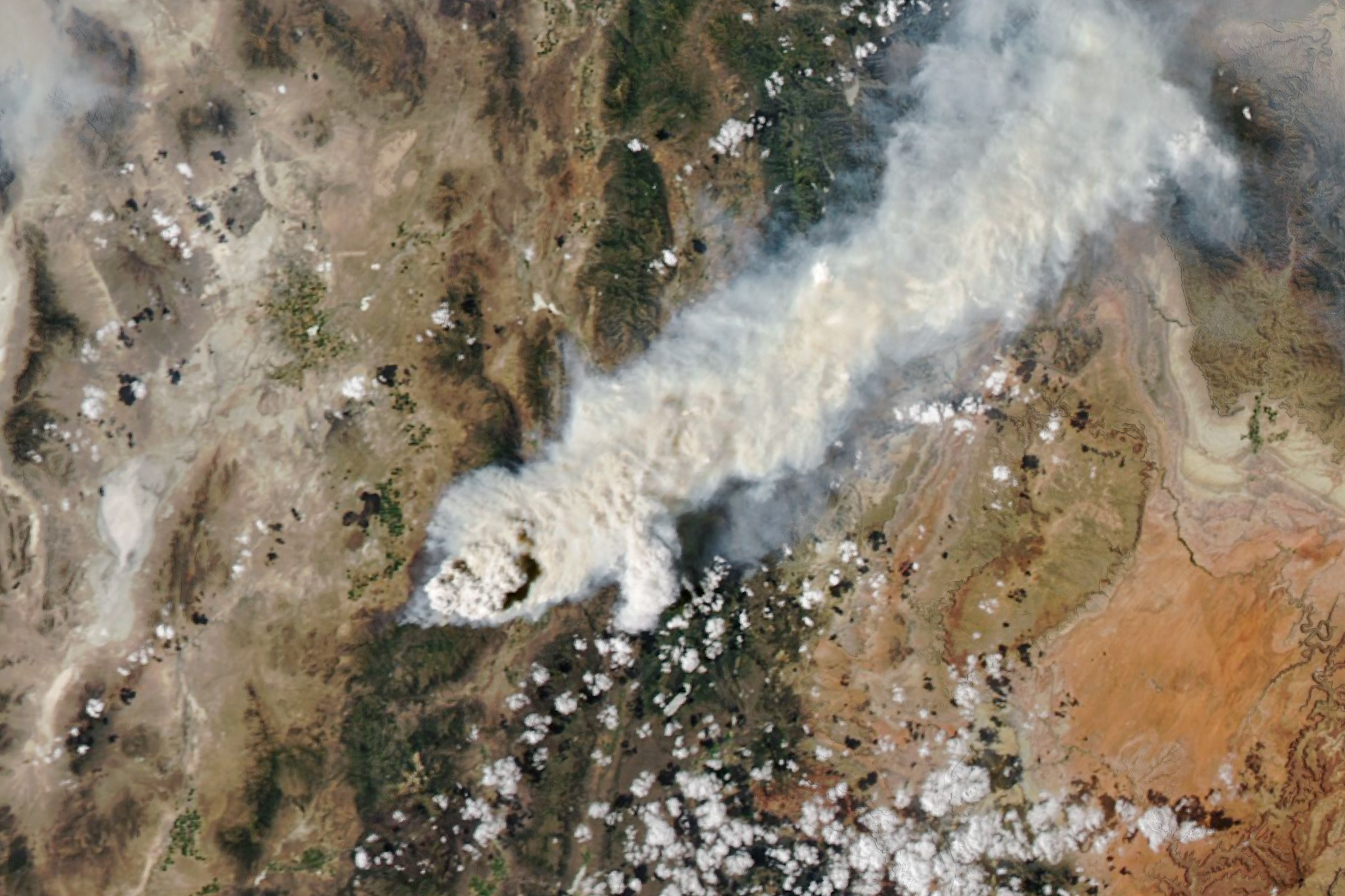
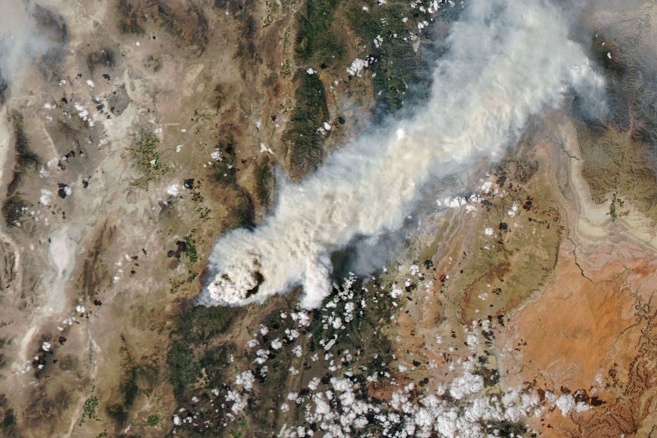
Natural Color
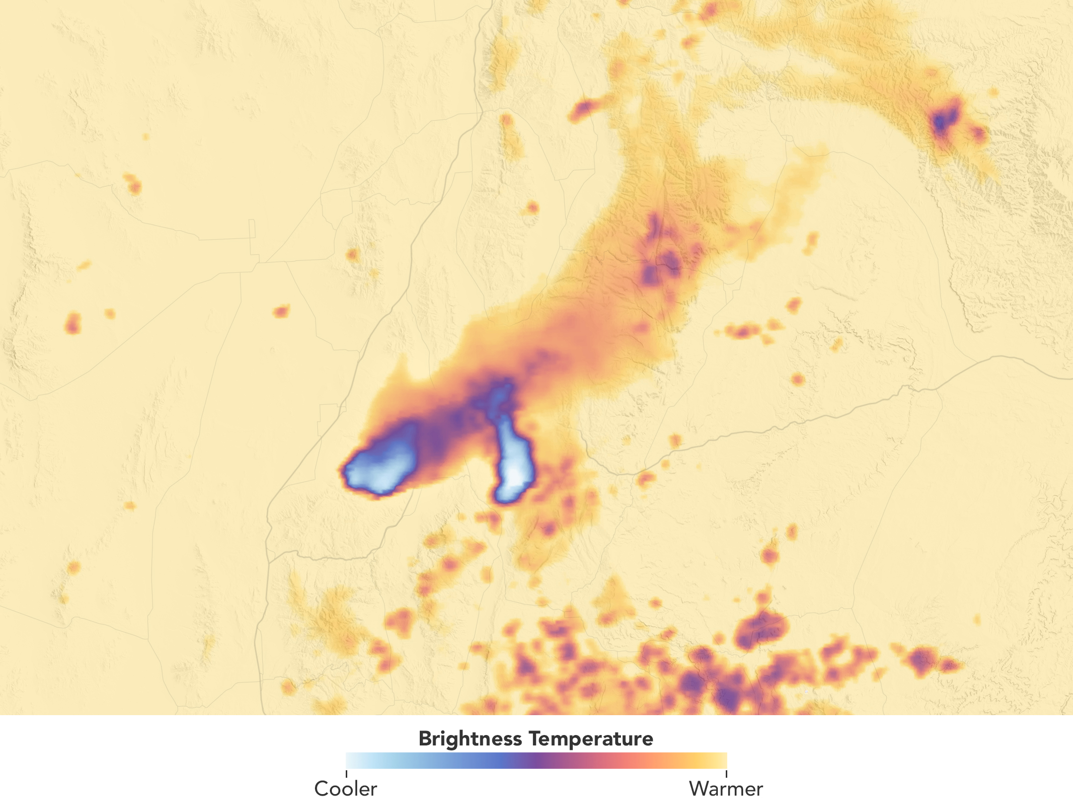
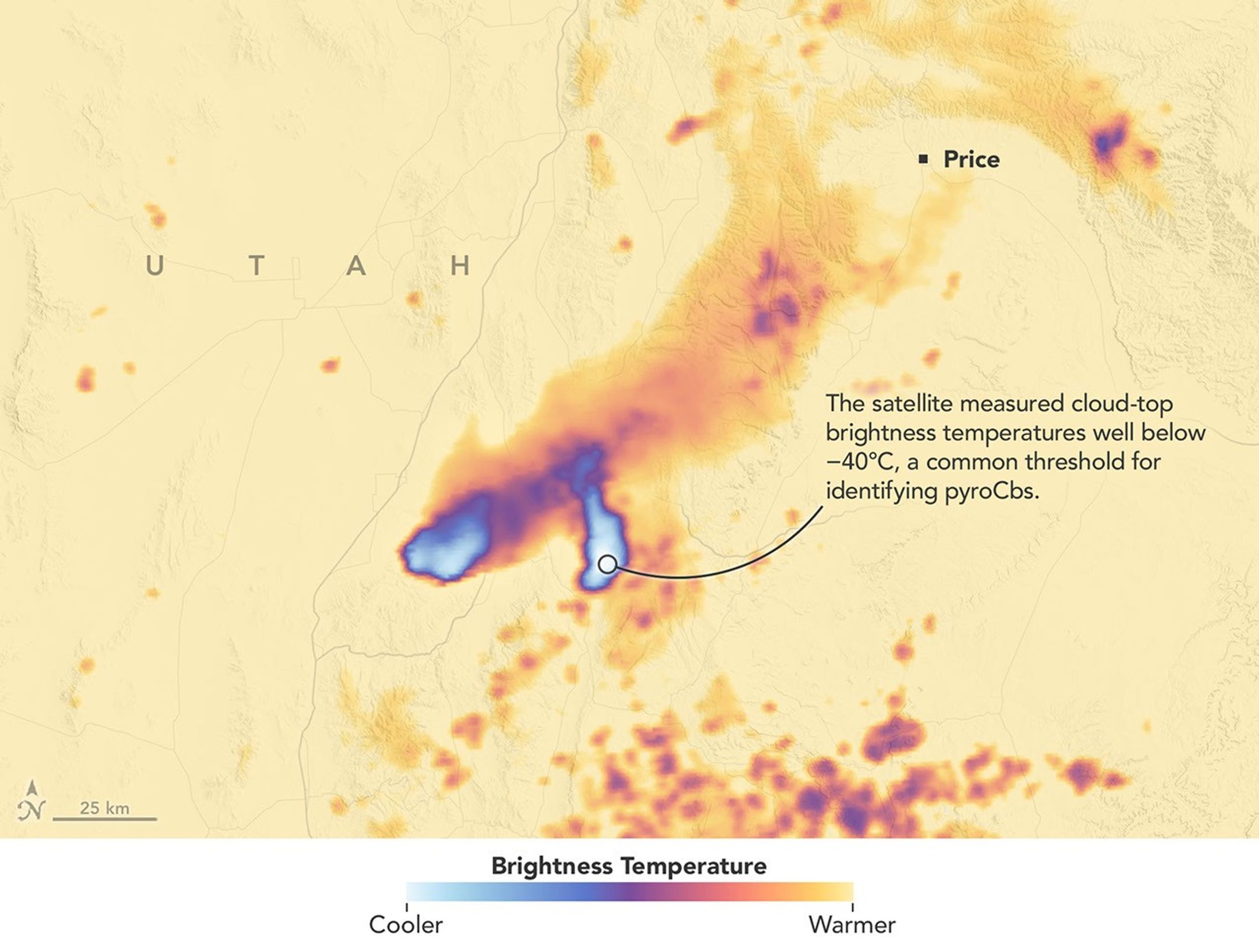
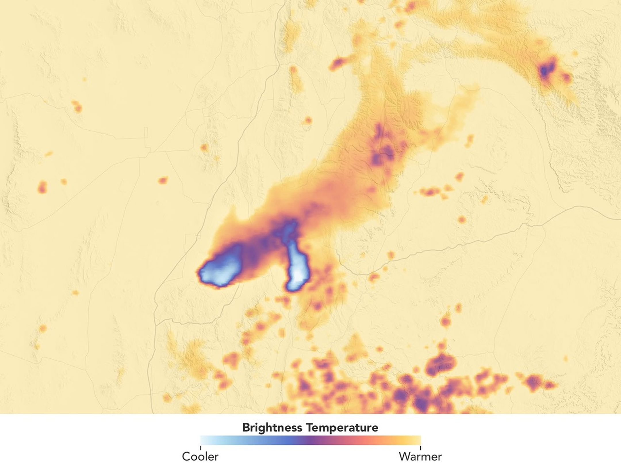
Brightness Temperature
Scientists have long known that volcanoes can launch large quantities of particles into the stratosphere. In the past few decades, it has become clear that wildfires do this, too, by generating towering, smoke-infused pyrocumulonimbus (pyroCb) clouds.
The largest pyroCbs are stunning weather-making features that generate massive thunderheads capable of unleashing lightning, hail, and heavy rain. A growing body of research shows that pyroCbs can also leave an outsized imprint on the upper atmosphere by channeling pulses of particles and gases into the stratosphere’s mostly dry, cloudless confines. Once there, smoke can spread widely and linger for months or years, sometimes circling the globe and likely influencing the ozone layer and Earth’s energy budget.
Understanding these enigmatic and dangerous clouds is why a team of atmospheric scientists—part of a NASA mission called INSPYRE (INjected Smoke and PYRocumulonimbus Experiment)—is spending the summer chasing them with NASA’s ER-2 aircraft, NSF/NCAR’s GV, and a suite of truck-based sensors. The team completed one of its first sampling runs of the summer on August 3, 2026, when the GV flew through a high-altitude pulse of smoke from the Widemouth 2 fire, one of Utah’s largest so far this year.
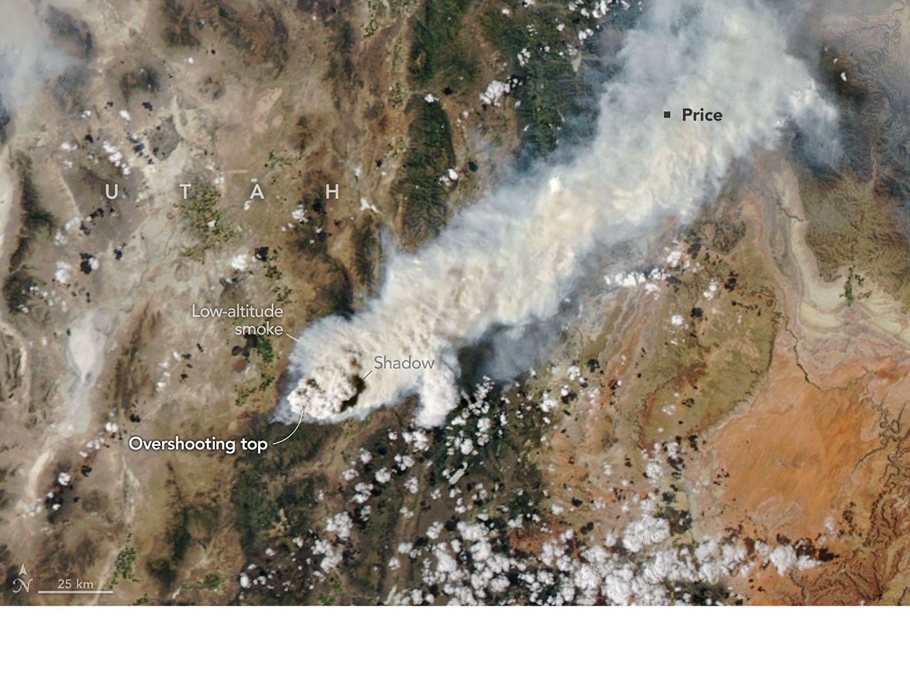
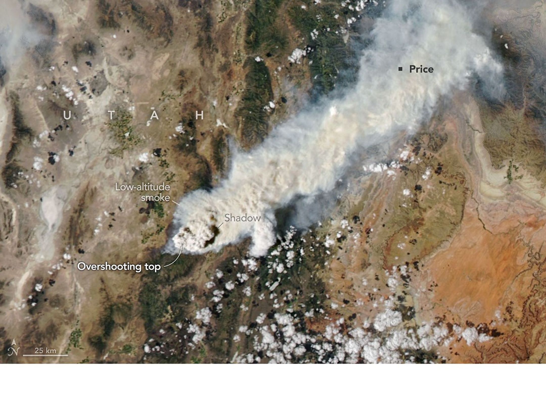
Lightning ignited the fire on July 27, 2026, but it remained relatively small until August 2, when it more than doubled in size amid intense winds and hot, dry conditions. That afternoon, soon after it had produced two pyroCb bursts, the MODIS (Moderate Resolution Imaging Spectroradiometer) on NASA’s Aqua satellite captured this image (above), showing a chimney of high-altitude cloud and smoke casting a shadow on low-altitude smoke below.
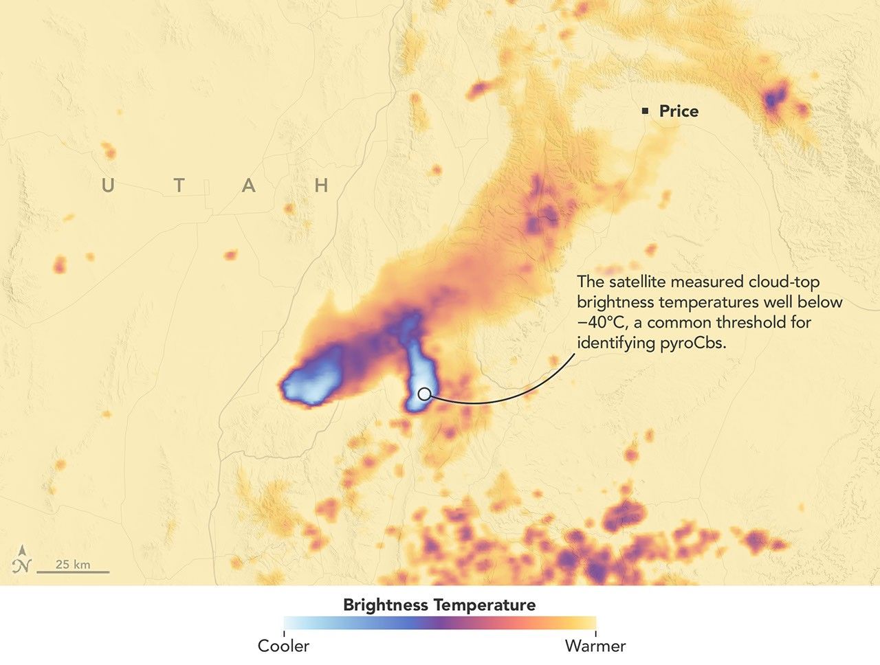
These bursts propelled clouds high enough that Aqua measured cloud-top brightness temperatures well below −40°C, a common threshold for identifying pyroCbs and a sign that the cloud tops were bubbling to the top of the troposphere and sometimes into the stratosphere. The brightness temperature measurements “reveal two discrete pulses of pyroCb action,” said Michael Fromm, a scientist at the U.S. Naval Research Laboratory. “The westernmost is the youngest pulse and stands out in the visible imagery by virtue of its shadow.”
Though relatively routine and minor, this pyroCb event followed a pre-dawn pyroCb from the same fire, imaged by the NOAA weather satellite GOES-West. “Morning pyroCbs are much more unusual,” Fromm said, because they don’t benefit from daytime heating that helps fuel convection. In this case, however, there appeared to be enough atmospheric instability and water vapor in the air to allow for pyroCb development.
Multiple pyroCbs in a single day could have added unwanted complexity for forecasters and fire officials battling the blaze and organizing evacuations, said David Peterson, INSPYRE’s principal investigator. “Minimizing that sort of uncertainty for fire forecasters is a big part of the reason we’re out here studying this,” he added.
Remote sensing experts like Peterson and Fromm routinely study pyroCbs from afar with satellites, but it’s less common for pilots to chase and sample smoke plumes just hours after they form. In this case, the GV aircraft, on the ground in Colorado when the Widemouth 2 fire blew up, made a beeline for a high-altitude smoke plume as it drifted over New Mexico on August 3. The instruments on the plane sampled smoke at roughly 12 kilometers (8 miles) above the surface, collecting data at a height that isn’t typically incorporated into forecast models.
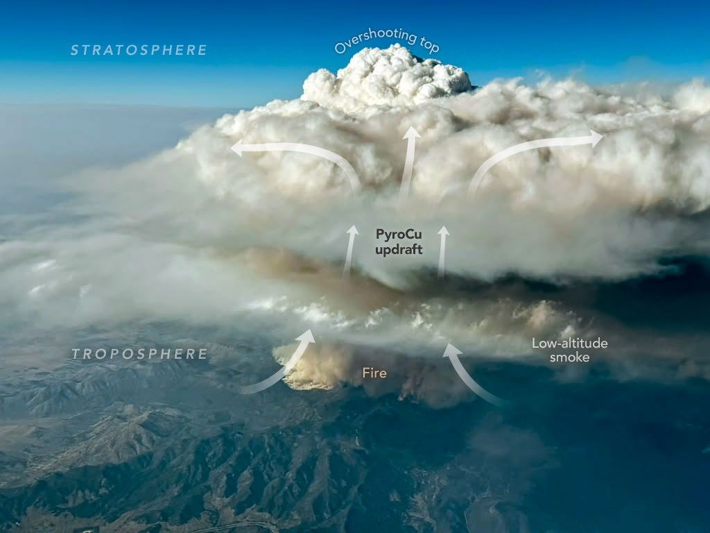
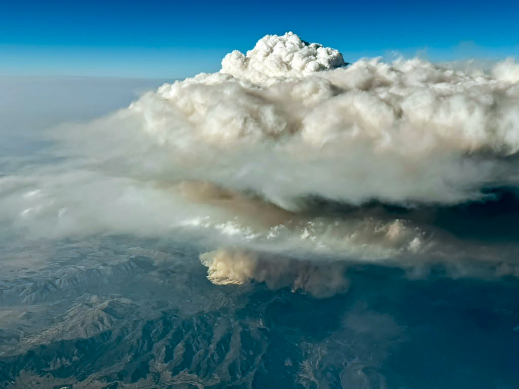
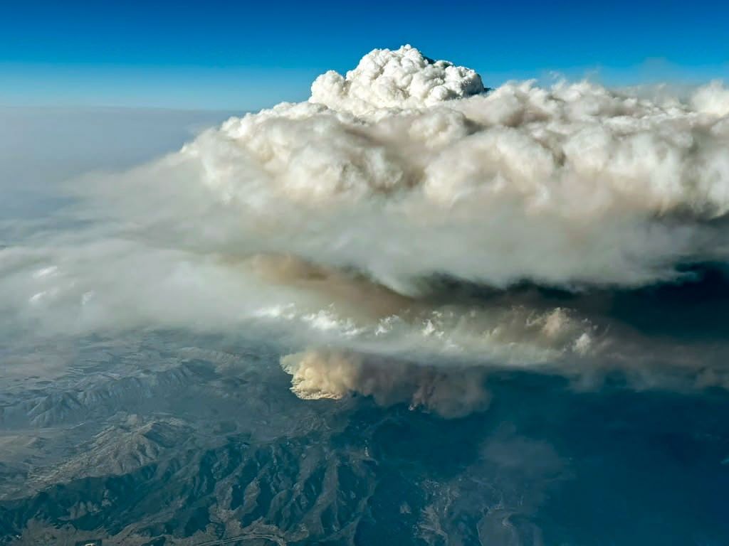
During that mission, a scientist on board captured this image (above) of a pyrocumulus (pyroCu) billowing up over the Widemouth 2 fire. While not as tall or energetic as pyroCbs, pyroCus are precursor clouds that share many of the same characteristics. Here, heat from the fire is fueling strong convective updrafts, forming a towering cloud with puffy overshooting tops that poke into the upper troposphere as lower-altitude smoke drifts below.
Satellites excel at identifying pyroCbs by measuring the temperature of the cloud tops that form above smoke plumes. Using this technique, researchers have established that wildfires produce about 70 pyroCbs per year, many in dense forests of Canada and Russia, though plenty also occur in grasslands and savannas in the United States and Australia. So far in 2026, Fromm and colleagues have identified at least 13 in the continental United States.
Since one of the first pyroCbs appeared in the scientific literature in the early 2000s, scientists have cataloged well over 700 events, and they now believe that wildfires may contribute up to 25 percent of the black carbon and organic aerosols in the lower stratosphere. The sheer frequency of pyroCbs means that the total mass of particles they inject over the course of a wildfire season may rival that of large volcanic eruptions.
Still, many questions about the enigmatic clouds remain unanswered. It isn’t clear what vegetation is most likely to fuel pyroCbs, why some form more lightning than others, why they form in only a small fraction of fires, and how to accurately forecast them.
“Whether it be their dangerous manifestations on the ground or their long-lasting imprint on the upper troposphere and lower stratosphere,” Fromm said, “pyroCbs continue to surprise us.”
NASA Earth Observatory images by Michala Garrison, using MODIS data from NASA EOSDIS LANCE and GIBS/Worldview. Photo by Bernadett Weinzierl/University of Vienna. Story by Adam Voiland.
References & Resources
- CIRA CSU, via Instagram (2026, August 3) Yesterday, the Widemouth 2 Fire in central Utah exploded. Accessed August 13, 2026.
- Denver 7, via Instagram (2026, July 28) Have you ever seen a smoke-filled cloud above a wildfire? Accessed August 13, 2026.
- The Economist (2026, August 9) NASA takes aim at fire storms. Accessed August 13, 2026.
- Fromm, M., et al. (2022) Understanding the critical elements of the pyrocumulonimbus storm sparked by high-intensity wildland fire. Communications Earth & Environment, 3, 243.
- InciWeb (2026) Widemouth 2 Fire. Accessed August 13, 2026.
- Katich, J.M. (2023) Pyrocumulonimbus affect average stratospheric aerosol composition. Science, 379(6634), 815-820.
- NASA (2026) INSPYRE. Accessed August 13, 2026.
- NASA Jet Propulsion Laboratory (2026, July 20) New NASA Earth Missions Gear Up to Start Science Flights. Accessed August 13, 2026.
- NASA Airborne Science Program (2026) Earth Science Observation Platforms. Accessed August 13, 2026.
- NASA Earth Observatory (2021, July 30) A Summer of Fire-Breathing Smoke Storms. Accessed August 13, 2026.
- NASA Earth Observatory (2020, January 10) Explosive Fire Activity in Australia. Accessed August 13, 2026.
- Peterson, D., et al. (2025) Worldwide inventory reveals the frequency and variability of pyrocumulonimbus and stratospheric smoke plumes during 2013–2023. Climate and Atmospheric Science, 8(325).
- The University of Utah (2026, August 6) Utah’s historic fire season of 2026. Accessed August 13, 2026.
- U.S. Naval Research Laboratory (2026, June 2) NRL Leads NASA Wildfire Research Mission to Better Predict Pyrocumulonimbus Storm Hazards. Accessed August 13, 2026.
- U.S. Naval Research Laboratory (2025, June 25) Fiery Storms: How Wildfires Create “Dirty Thunderstorms” and Impact Weather. Accessed August 13, 2026.
- The Weather Channel (2026, August 10) Meet the scientists who are flying into fire-breathing thunderstorms, and learn why they are doing it. Accessed August 13, 2026.
- Western Fire Chiefs (2026) Widemouth 2. Accessed August 13, 2026.
- World Meteorological Organization, Flammagenitus. Accessed August 13, 2026.
You may also be interested in:
Stay up-to-date with the latest content from NASA as we explore the universe and discover more about our home planet.

The blaze burned more than 150 square miles and swept through parts of a ski resort.

Canadian wildfires sent plumes of smoke streaming over Ontario, Quebec, and parts of the U.S. Midwest and Northeast.
From the International Space Station, astronauts photographed Mount Hood and Mount Rainier as wildfire smoke spread across the Pacific Northwest…
Discover More from NASA Earth Science
Subscribe to Earth Observatory Newsletters
Subscribe to the Earth Observatory and get the Earth in your inbox.

Earth Observatory Image of the Day
NASA’s Earth Observatory brings you the Earth, every day, with in-depth stories and stunning imagery.

Explore Earth Science

Earth Science Data
Open access to NASA’s archive of Earth science data